Relief (Relievo)
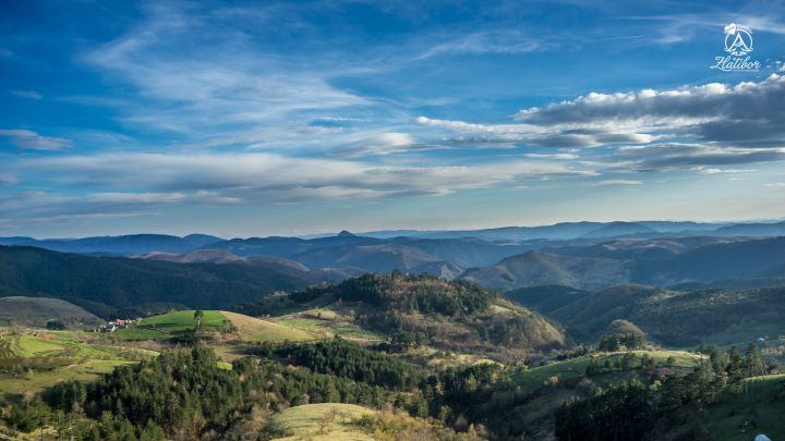
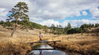
Zlatibor is a mountain of plateau type, it is undulating landscape clearly different from its surrounding. By these high and steep slopes, Zlatibor is separated from its surroundings into individual morphological whole, with special geographical characteristics.
The slopes are particularly emphasized on its east and northeast part. They begin with Savino Brdo (1132m) on the northeast and they end with Čajetina’s Gradina (1160m) across Gruda (1140m), Čavik (1018m) and Obadovo brdo (948m).
These slopes form a straight line row that raises 300 – 350 m over Braneško polje and the Sušica river valley. Near Čajetina its straight line direction is strongly violated by erosive breakthrough of the Blašica, a tributary of the Sušica.
By erosive effect of that flow, slope is moved back to Palisad hotel. In this expansion, shaped like an amphitheater, the town of Čajetina is settled, the seat of municipality of the same name. From Gradina of Čajetina to the south the east border of Zlatibor begins, also bordered by steep slopes. In fact, the row of slopes goes straight further under the mountain of Pjevčak (1040m), Bojište (1066m) and Savića glava (977m), including Alin Potok in the Zlatibor plateau. Not only by the height, but also by steep slope, Zlatibor plateau is the highest above the landscape on the east side from Čigota.
The mountain slops extend further to the south into the spring of the river Ljubiška, where they go right into the mountain massif of Murtenica. Southeastern and eastern slopes of Zlatibor represent rifted sections along which Zlatibor protruded from the surrounding terrain. The straight-line nature of these sections, their steepness and drooping of the limestone masses in their pedestal are geological characteristics of these faulting. With later erosive flow of rivers, these sections were moved, so Zlatibor plateau had been strongly devastated. Such erosive incursions are the most prominent near Čajetina and the Katušnica spring.
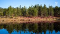
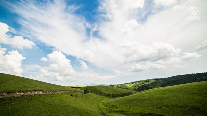
Therefore, from the Zlatibor plateau to the east, its parts protrude like capes or flaps. One of these lobes is a range of Murtenica. Although, by some morphological characteristics, it represents an extension of Zlatibor plateau, by its other features significantly differs from it. Murtenica range begins to rise at Zlatibor plateau by Šišanik and Svijetnjak slope, and Brijač (1480m) is its highest peak. From there to southeast it gradually lowers and elongates in the surrounding limestone terrain, so it loses morphological and landscape characteristics of Zlatibor plateau. Towards the southwest side Zlatibor plateau is noticably marked by high and more than 10 m long range of Tornik. This range starts at Borova glava (1147 m) and it gradually rises towards northwest to reach its greatest hights at Ravan Tornik (1431m) and Veliki Tornik (1496 m). From Veliki Tornik towards northwest its range becomes much lower till it comes to the saddle at Đurović groblje, where it ends.
Borova glava saddle separates two mountain ranges: the Tornički and the Murtenički one and also makes the final southeast border of Zlatibor plateau. While northeastern, eastern and southwestern borders of Zlatibor plateau are represented by high extreme slopes, its western borders are not clear: they stretch from the valley of Jablanica river, breaking out into Crni Rzav river, one kilometer downstream from the confluence of the Ribnica river and over Lisičina (1067 m), Lupoglav (1092 m) and Bar they come to Viogor (1281 m), the highest elevation of Semegnjevska gora. Part of the western border of Zlatibor under Lisičina, Lupoglav and Viogor is also surrounded by high steep slopes through which smaller streams flow, which did not leave more striking marks. Semegnjevska gora closes the borders of Zlatibor plateau in geomorphological terms.